Développer des solutions digitales et des services innovants pour optimiser les infrastructures de l'eau et contribuer au développement raisonné des territoires et à l'adaptation au changement climatique.
L’innovation et le digital regroupent les activités d’édition de solutions digitales, de R&D et de création de services d’ingénierie innovants.
Nos solutions digitales sont des SIG métier ou des applications métier personnalisables dans les domaines de l’eau et des territoires.
Nous éditons aussi des applications spécifiques visant à digitaliser des processus de maîtrise d’ouvrage comme le contrôle de conformité des branchements d’assainissement ou la gestion patrimoniale des réseaux d’eau.
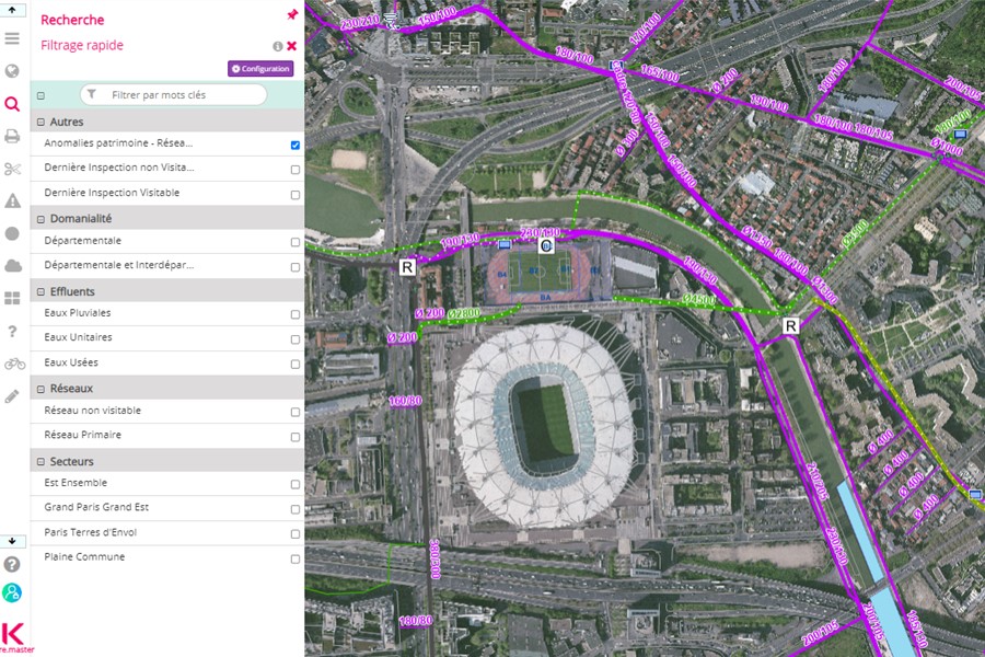
SIG métier eau potable, assainissement et plus
KIS®
Conçue et développée par les équipes d’Altereo Innovation et Digital, en lien avec nos ingénieurs en hydraulique urbaine, KIS® est un Système d’Information Géographique (SIG) métier 100% Web dédié aux services d’eau et d’assainissement et pour d’autres usages à la demande comme la gestion de la reforestation.
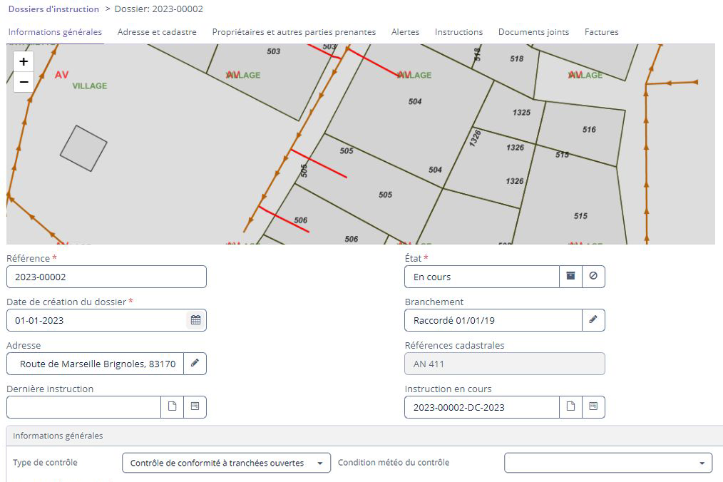
Application métier pour gérer le contrôle des branchements d’assainissement collectif
ID BAC
[Nouveau] Altereo Innovation et Digital lance ID BAC, application 100% Web dédiée à la gestion et au suivi des contrôles de conformité des branchements d’assainissement collectif.
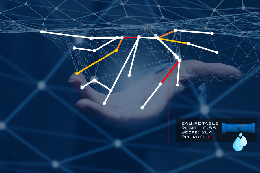
Solutions pour digitaliser le processus de gestion patrimoniale des réseaux d’eau potable
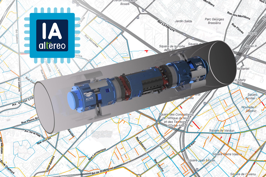
HpO®(exploite l’intelligence artificielle)
Outils digitaux répondant aux besoins des services d’eau potable tout au long du processus de gestion patrimoniale, de la structuration des donnéeset de l’organisationdu service jusqu’à la prédiction par IA du risque de défaillance et l’optimisation automatisée des chantiers de renouvellement.
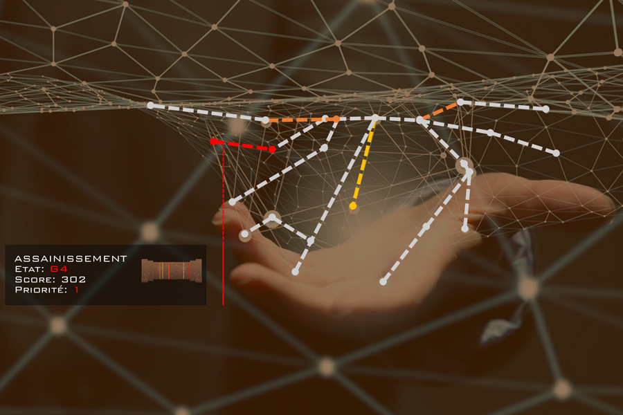
Solutions pour digitaliser le processus de gestion patrimoniale des réseaux d’assainissement
Indigau®(exploite un modèle unique de notation d’ITV)
Outils digitaux répondant aux besoins des services d’assainissement tout au long du processus de gestion patrimoniale, de la structuration des donnéeset de l’organisationdu service jusqu’au traitement automatisé des inspections télévisées et le ciblage du renouvellement / réhabilitation des canalisations.
Les services d’ingénierie innovants peuvent être de la data-ingénierie, de la mise en œuvre d’algorithmes pour déceler le potentiel de réduction de pression et de production de micro-électricité sur les réseaux d’eau potable ou encore de la modélisation de trajectoires Zéro Artificialisation Nette (ZAN) ou de potentiel de désimperméabilisation pour les territoires.
Faites de la gestion des eaux pluviales urbaines une clé d’adaptation de votre territoire au changement climatique
Alter-RAIN®
Grâce au diagnostic du potentiel de désimperméabilisation et de déconnexion des eaux pluviales
Tout en bénéficiant des recommandations de nos experts
Nous accompagnons la transition écologique et énergétique des services d’eau en agissant sur l’optimisation des pompages, la réduction des pressions excessives et jusqu’à l’implantation de micro-turbines.
Développer des solutions digitales et des services innovants pour optimiser les infrastructures de l'eau et contribuer au développement raisonné des territoires et à l'adaptation au changement climatique.
La R&D est inscrite dans l’ADN d’Altereo depuis plus de 20 ans. Explorant les domaines métier du groupe et souvent soutenue par les financements et labels de l’État tels que Greentech Innovation, la R&D d’Altereo lui a toujours permis d’avoir une longueur d’avance sur des thématiques d’avenir et d’apporter aux maîtres d’ouvrage des services d’ingénierie ou des logiciels innovants.
La R&D d’Altereo est aujourd’hui organisée en 3 unités :